DWER relevant regional office based on Local Government Authority (LGA) boundaries map and table

Guidance
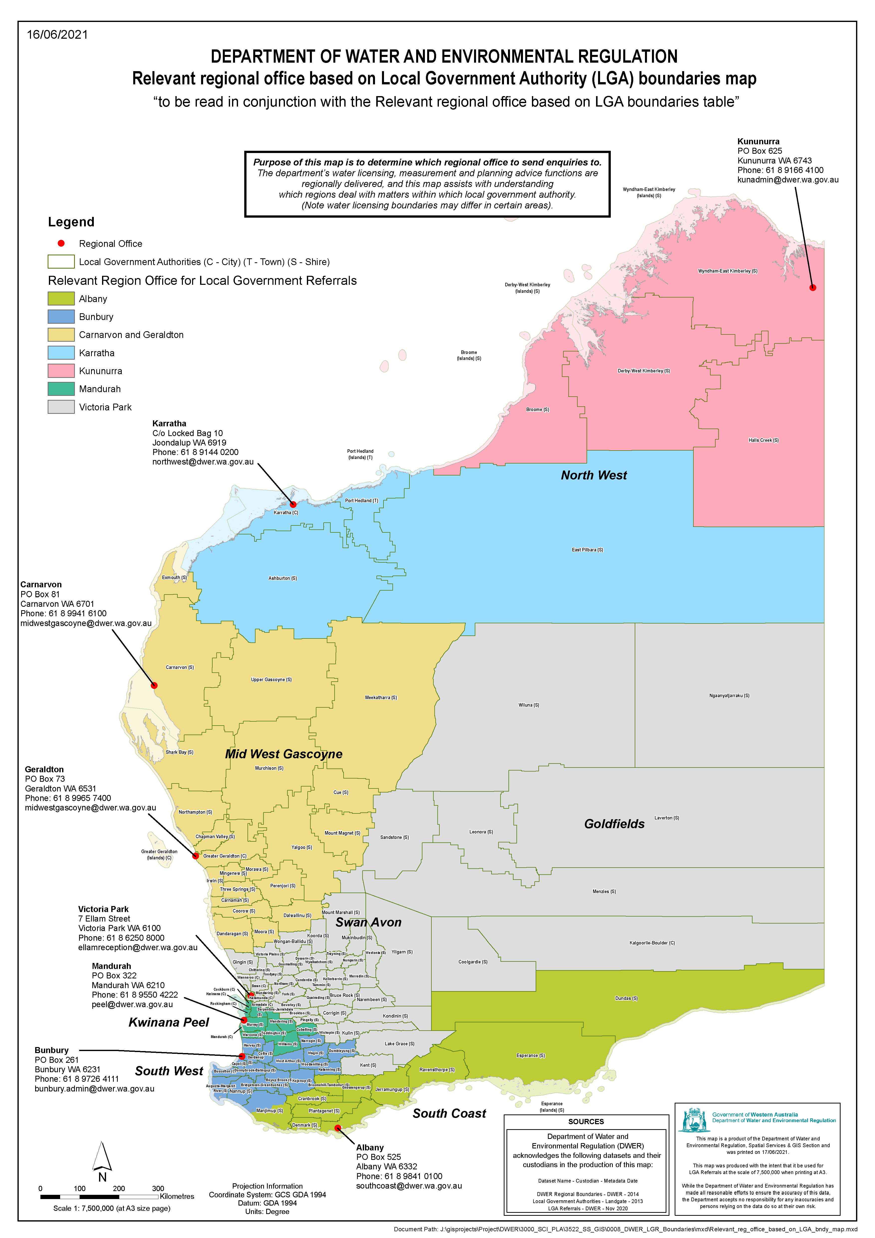
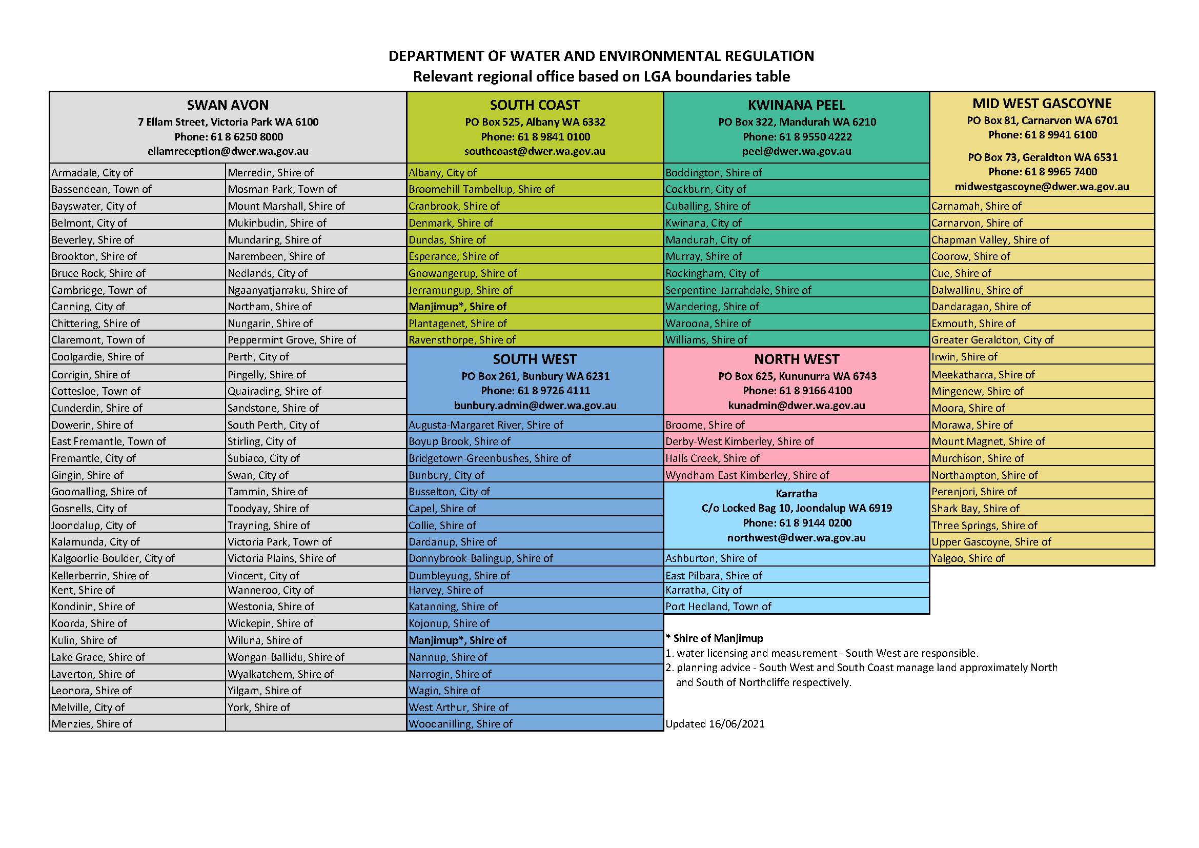
DWER relevant regional offices based on LGA boundaries map to be read in conjunction with the table
Last updated:

Our water licensing, measurement and planning advice functions are regionally delivered. This map and table assist with understanding which regions deal with matters within which local government authority.

(Note water licensing boundaries may differ in certain areas).

DWER relevant regional office based on Local Government Authority (LGA) boundaries map


Relevant regional office based on LGA boundaries table

Please download the PDF versions below.

Go to our regional offices page for contact details.

Was this page useful?